Wow, not to sure that was the reaction you were expecting, caused a bit of a stir. If there is anyone on this forum that is weather conscious and promotes save flying, it is definitely you. This being evident with the weekly Windguru Weather Forecast that you post on forum. This has prompted me to utilise this site for our local weather conditions, thank you. Keep posting interesting topic's.
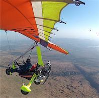
Flying a GPS Approach in a Trike!
-
Station Kariba

- First solo
- Posts: 87
- Joined: Tue Jun 29, 2010 11:15 am
Re: Flying a GPS Approach in a Trike!
John
Wow, not to sure that was the reaction you were expecting, caused a bit of a stir. If there is anyone on this forum that is weather conscious and promotes save flying, it is definitely you. This being evident with the weekly Windguru Weather Forecast that you post on forum. This has prompted me to utilise this site for our local weather conditions, thank you. Keep posting interesting topic's.
Wow, not to sure that was the reaction you were expecting, caused a bit of a stir. If there is anyone on this forum that is weather conscious and promotes save flying, it is definitely you. This being evident with the weekly Windguru Weather Forecast that you post on forum. This has prompted me to utilise this site for our local weather conditions, thank you. Keep posting interesting topic's.
Graham Galloway
Z-RUM
Z-TOC
Z-HAY
Z-RUM
Z-TOC
Z-HAY
-
John.com
- Frequent Flyer

- Posts: 1288
- Joined: Tue Nov 08, 2011 8:31 pm
- Location: Broederstroom (Magaliesberg) - home airstrip Aeroden
Re: Flying a GPS Approach in a Trike!
Hi Justin,justin.schoeman wrote:About the only functional requirement for a GPS used for GPS approaches, which is not provided in typical navigation GPSs, is that it must clearly indicate when accuracy falls below specified minimum levels.
Your typical navigation GPS will continue providing best guess information, even if signal conditions are such that accuracy is degraded to a few hundred meters...
For an IFR rated pilot to fly an approved GPS approach without an approved GPS would be dangerous and foolhardy.
I hear you. But a few hundred metres? I regularly monitor my GPS accuracy when flying and 20m is about the maximum accuracy that I have seen.
What I find intriguing ('just putting it out there) is the accuracy that can be achieved with say an iPhone GPS. I use an app called Endomondo (http://www.endomondo.com/) for running and the accuracy is mind boggling. The 'coach' on the app asks if she must pause the recording when I stop to tie a shoe lace. Then, when I return from my run and review my course on Google Maps it is SPOT ON! What I am eluding to is that surely even low-end (iPhone-type) GPSes have evolved into fairly respectable navigation tools with a fairly high degree of accuracy?
On this note, look at what this mountain biker did when on a ride along the beach! He achieved this by pausing and starting the Endemondo app as he created the letters!
Click here to verify that this is for real! http://www.endomondo.com/workouts/78513629
OK, so this is a high level view of his course:
Anyway, back to the discussion around GPS accuracy . . . . this surely demonstrates what accuracy levels are like on simple GPS devices.
Cheers,
John.com
Last edited by John.com on Tue Oct 16, 2012 10:48 am, edited 1 time in total.
John Comley
ZU-BST (the Beautiful Seductive Temptress)
Magaliesberg, South Africa
Read my flying blog here . . . http://johncomley.blogspot.com/
"Truly superior pilots are those who use their superior judgment to avoid those situations where they might have to use their superior skills"
ZU-BST (the Beautiful Seductive Temptress)
Magaliesberg, South Africa
Read my flying blog here . . . http://johncomley.blogspot.com/
"Truly superior pilots are those who use their superior judgment to avoid those situations where they might have to use their superior skills"
-
John.com
- Frequent Flyer
- Posts: 1288
- Joined: Tue Nov 08, 2011 8:31 pm
- Location: Broederstroom (Magaliesberg) - home airstrip Aeroden
Re: Flying a GPS Approach in a Trike!
Hey Graham!Station Kariba wrote:John
Wow, not to sure that was the reaction you were expecting, caused a bit of a stir. If there is anyone on this forum that is weather conscious and promotes save flying, it is definitely you. This being evident with the weekly Windguru Weather Forecast that you post on forum. This has prompted me to utilise this site for our local weather conditions, thank you. Keep posting interesting topic's.
I knew that my "GPS Approaches" blog would be controversial, so I'm totally ok with it!
I'm an engineer, so like to question the norms and to test things in a safe and controlled manner!
And, I really appreciate all the comments and discussion!
Cheers,
John.com
John Comley
ZU-BST (the Beautiful Seductive Temptress)
Magaliesberg, South Africa
Read my flying blog here . . . http://johncomley.blogspot.com/
"Truly superior pilots are those who use their superior judgment to avoid those situations where they might have to use their superior skills"
ZU-BST (the Beautiful Seductive Temptress)
Magaliesberg, South Africa
Read my flying blog here . . . http://johncomley.blogspot.com/
"Truly superior pilots are those who use their superior judgment to avoid those situations where they might have to use their superior skills"
-
justin.schoeman
- Frequent Flyer
- Posts: 1234
- Joined: Tue Aug 30, 2005 5:25 pm
- Location: Pretoria
Re: Flying a GPS Approach in a Trike!
GPS conditions are usually good. It takes some exceptionally bad luck these days, but it does still happen. The worst I have seen recently is only three visible satellites with a reported precision of 500m (and no vertical information). And of course, once your GPS antenna gets wet (which may be a good possibility in poor vis conditions), things get worse a lot quicker.John.com wrote:Hi Justin,justin.schoeman wrote:About the only functional requirement for a GPS used for GPS approaches, which is not provided in typical navigation GPSs, is that it must clearly indicate when accuracy falls below specified minimum levels.
Your typical navigation GPS will continue providing best guess information, even if signal conditions are such that accuracy is degraded to a few hundred meters...
For an IFR rated pilot to fly an approved GPS approach without an approved GPS would be dangerous and foolhardy.
I hear you. But a few hundred metres? I regularly monitor my GPS accuracy when flying and 20m is about the maximum accuracy that I have seen.
-
John.com
- Frequent Flyer
- Posts: 1288
- Joined: Tue Nov 08, 2011 8:31 pm
- Location: Broederstroom (Magaliesberg) - home airstrip Aeroden
Re: Flying a GPS Approach in a Trike!
That's good guidance, thank you!justin.schoeman wrote: GPS conditions are usually good. It takes some exceptionally bad luck these days, but it does still happen. The worst I have seen recently is only three visible satellites with a reported precision of 500m (and no vertical information). And of course, once your GPS antenna gets wet (which may be a good possibility in poor vis conditions), things get worse a lot quicker.
John Comley
ZU-BST (the Beautiful Seductive Temptress)
Magaliesberg, South Africa
Read my flying blog here . . . http://johncomley.blogspot.com/
"Truly superior pilots are those who use their superior judgment to avoid those situations where they might have to use their superior skills"
ZU-BST (the Beautiful Seductive Temptress)
Magaliesberg, South Africa
Read my flying blog here . . . http://johncomley.blogspot.com/
"Truly superior pilots are those who use their superior judgment to avoid those situations where they might have to use their superior skills"
-
gertcoetzee

- Frequent Flyer
- Posts: 1303
- Joined: Mon May 23, 2005 1:01 pm
- Location: Cape Town
- Contact:
Re: Flying a GPS Approach in a Trike!
John, you should have started the discussion with "I'm an engineer", makes much more sense that way. 
I have done the same at Morningstar, except I did it the easy way - I am not an engineer. I flew out, taking a "approach" slope, pressed the waypoint button a couple of times on the way out, and flew it in reverse.
An interesting excercise, not to be repeated in adverse conditions, I think.
Having said that, somewhere on my sitehttp://www.zu-dve.com I related how I flew into Langebaanweg, with me knowing there are no high structures, and fog limiting my visibility to below me. They were monitoring me on their radar (which they claim can count the number of birds in a flock) - could tell me my exact position in 3D and guided me to their runway. Was interesting. That advice about just keeping your hand lightly on the bar worked as well.
Gert
-
John.com
- Frequent Flyer
- Posts: 1288
- Joined: Tue Nov 08, 2011 8:31 pm
- Location: Broederstroom (Magaliesberg) - home airstrip Aeroden
Re: Flying a GPS Approach in a Trike!
Aha! So, I'm not the only madman out there!!gertcoetzee wrote:John, you should have started the discussion with "I'm an engineer", makes much more sense that way.
I have done the same at Morningstar, except I did it the easy way - I am not an engineer. I flew out, taking a "approach" slope, pressed the waypoint button a couple of times on the way out, and flew it in reverse.
An interesting excercise, not to be repeated in adverse conditions, I think.
Having said that, somewhere on my sitehttp://www.zu-dve.com I related how I flew into Langebaanweg, with me knowing there are no high structures, and fog limiting my visibility to below me. They were monitoring me on their radar (which they claim can count the number of birds in a flock) - could tell me my exact position in 3D and guided me to their runway. Was interesting. That advice about just keeping your hand lightly on the bar worked as well.
Gert
Cheers Gert!
John Comley
ZU-BST (the Beautiful Seductive Temptress)
Magaliesberg, South Africa
Read my flying blog here . . . http://johncomley.blogspot.com/
"Truly superior pilots are those who use their superior judgment to avoid those situations where they might have to use their superior skills"
ZU-BST (the Beautiful Seductive Temptress)
Magaliesberg, South Africa
Read my flying blog here . . . http://johncomley.blogspot.com/
"Truly superior pilots are those who use their superior judgment to avoid those situations where they might have to use their superior skills"
-
tka
- Ready for the first flight
- Posts: 47
- Joined: Fri Jul 27, 2012 9:33 pm
- Location: Ballito microlight field and King Shaka / Durban
Re: Flying a GPS Approach in a Trike!
[quote="....... So, I'm not the only madman out there!![/quote]
Yip, just 2 left. The others died flying gps approaches
Yip, just 2 left. The others died flying gps approaches
-
John.com
- Frequent Flyer
- Posts: 1288
- Joined: Tue Nov 08, 2011 8:31 pm
- Location: Broederstroom (Magaliesberg) - home airstrip Aeroden
Re: Flying a GPS Approach in a Trike!
Most comments posted up to the juncture have been constructive, even if negative.tka wrote:[quote="....... So, I'm not the only madman out there!!
Yip, just 2 left. The others died flying gps approaches
Please watch the video and repost how you see my life being at risk by flying a GPS approach in FULL VISIBILITY, which, if you have read the entire post, you would understand that this was the context of the post!
Should the remote chance occur that I get caught out in IMC on my return to Aeroden and need to use a a predefined GPS approach to get me lined up and within visual range of Aeroden 18 you will be one of those I will let know of the benefits of having a GPS approach on tap as that 'Plan Z'!
FYI: Flying with a 2,500ft mountain adjacent your home airfield does pose regular threats w.r.t weather (in particular cloud conditions changing, sometimes rapidly). And yes, on more than one occasion, returning over the mountain from the south I have had to fly ABOVE 5/8 borderline cloud to maintain separation from the mountain and then have to pick my way down on the northern side of the ridge for landing back at Aeroden. So yes, flying into a situation like this you are constantly challenged with options such as to turn around and return to where you came from, but with possible fuel issues such a decision becomes borderline in itself and then rapidly reduces your options should other factors come into play such as a headwind or, dare I suggest, WORSE IMC conditions, but now WITHOUT the option of a pre-planned GPS approach to an airfield you are familiar with!
Finally, this topic was not intended to place the life of any pilot in danger. Completely the opposite, in fact! I remain hopeful that the majority of pilots get that!
Safe Skies
John.com
Last edited by John.com on Wed Oct 17, 2012 11:13 am, edited 1 time in total.
John Comley
ZU-BST (the Beautiful Seductive Temptress)
Magaliesberg, South Africa
Read my flying blog here . . . http://johncomley.blogspot.com/
"Truly superior pilots are those who use their superior judgment to avoid those situations where they might have to use their superior skills"
ZU-BST (the Beautiful Seductive Temptress)
Magaliesberg, South Africa
Read my flying blog here . . . http://johncomley.blogspot.com/
"Truly superior pilots are those who use their superior judgment to avoid those situations where they might have to use their superior skills"

Re: Flying a GPS Approach in a Trike!
Hi John, yes a very controversial one but I see your point and I must agree with you in the strongest terms that this is not an option....but rather a last resort.
My feeling is as many others share...if you end up in a situation requiring an "attempted" GPS approach, you've already screwed up badly!
I understand your point and if anything it can be shown that the Nav aids we have today are absolutely amazing but I dont think that you, me or anyone not used to IMC would be successful in a real situation.
You have completed the sequence in visual conditions...but IMC will be a whole different ballgame. Remember that at all times on your approach, you still had the runway in sight. Even if your eyes were fixated on the GPS, your peripherals will be "enhancing" the accuracy of your control imputs? Please share your thoughts on this. Stress, low vis, disorientation will be massive factors in the chances of any successful approach.
Also...an approach is one thing...what about the almost ineveitable Go Around when you suddenly realise that you are 10 or 20 M too high or left or right of the runway as it appears out of the gloom? That's a pretty big chunck of rock on the south side of Aeroden! I'd hate to try and "miss" it in a cloud 
I'm not shooting you down John , I find it an interesting topic but I'd say the chances are pretty close to zero? LCC rules are the best advice on this one for sure. NEVER Close the back door. (And I know you were not advocating this as an option  )
)
Thanks for posting some really thought provoking topics. They all contibute to the learning.
My feeling is as many others share...if you end up in a situation requiring an "attempted" GPS approach, you've already screwed up badly!
I understand your point and if anything it can be shown that the Nav aids we have today are absolutely amazing but I dont think that you, me or anyone not used to IMC would be successful in a real situation.
You have completed the sequence in visual conditions...but IMC will be a whole different ballgame. Remember that at all times on your approach, you still had the runway in sight. Even if your eyes were fixated on the GPS, your peripherals will be "enhancing" the accuracy of your control imputs? Please share your thoughts on this. Stress, low vis, disorientation will be massive factors in the chances of any successful approach.
Also...an approach is one thing...what about the almost ineveitable Go Around when you suddenly realise that you are 10 or 20 M too high or left or right of the runway as it appears out of the gloom? That's a pretty big chunck of rock on the south side of Aeroden!
I'm not shooting you down John
Thanks for posting some really thought provoking topics. They all contibute to the learning.

Re: Flying a GPS Approach in a Trike!
????????? - maybe plan Z might be needed sooner or later ??John.com wrote:Yes, thanks Sue . . . sure it was windy, but it was still great fun! Your boerie rolls rock!Air Hog wrote:Well, the Kroon guys could not fly in because of low clouds (Red and White Radio mast completely covered) but then we decided we would drive in for those famous boerie rolls.
When we arrived there, there were some brave pilots. Turbo Goose in the Turbo Kit Fox, Mike in his Bantam and a Fox Bat. But then, the bravest of them all, John.com arrived, the only Trike.
Thank you Sue, it was great meeting you.
I know the weather was a little rough but I can without hesitation say that it was my finest flying hour to-date (20mins there and 40mins back!
I could well be out there again tomorrow!!
Parasitic Drag: A pilot who bums a ride and complains about the service.
ZU - forePLaY
ZU - forePLaY

Re: Flying a GPS Approach in a Trike!
I know of a pilot who tried this plan Z in a trike. He is no longer with us. That is as much a lesson as I need that it should not even feature as a Plan at all.
-
John.com
- Frequent Flyer
- Posts: 1288
- Joined: Tue Nov 08, 2011 8:31 pm
- Location: Broederstroom (Magaliesberg) - home airstrip Aeroden
Re: Flying a GPS Approach in a Trike!
You're on the money Thatchman! This was the one experience that provoked my thinking around GPS approaches!Thatchman wrote:????????? - maybe plan Z might be needed sooner or later ??
This exact experience, paraphrased, was . . .
"I took off from Sue's Airstrip. The cloud was borderline VFR but had I to go 'over the top' to clear the Magaliesberg and get back to Aeroden, so I climbed through broken cloud, with the option (back door open) of returning to Sue's Strip once above the cloud base and assessing the extent and thickness of the cloud. Once above the cloud base, I looked north and saw large breaks in the clouds towards Brits. The Drie Berg mountains (west of Brits) were quite visible (NOT just poking through clouds!), so I continued above the clouds at around 7,500ft. Directly over the northern ridge the clouds were completely solid, prompting either a return to Sue's Airstrip or to continue on to Brits, descend and then return to Aeroden below the cloud base. It was a 50/50 call and so I continued. Due to the nature of cloud, looking back towards Sue's Airfield the cloud now looked solid although was probably was still VFR. Just beyond the Platinum Highway there was a large break in the clouds which I descended through, turned south and then landed safely at Aeroden on 18."
So, yes, your observations are right, this is one situation that prompted by thoughts around having a GPS approach as a 'Plan Z', i.e. What if the situation suddenly changed and I was caught out in IMC? In fact, I spent weeks reflecting on the options that were open to me at the time, my assessment of the situation, and the decisions I had made along with the risks associated with these decisions.
As per my original post, this was an extremely testing situation in terms of having to make important go/don't go decisions, but again, as per my post, it remains one of my best flying experiences.
Thanks for your observations and comments.
Safe Skies!
John.com
John Comley
ZU-BST (the Beautiful Seductive Temptress)
Magaliesberg, South Africa
Read my flying blog here . . . http://johncomley.blogspot.com/
"Truly superior pilots are those who use their superior judgment to avoid those situations where they might have to use their superior skills"
ZU-BST (the Beautiful Seductive Temptress)
Magaliesberg, South Africa
Read my flying blog here . . . http://johncomley.blogspot.com/
"Truly superior pilots are those who use their superior judgment to avoid those situations where they might have to use their superior skills"
Re: Flying a GPS Approach in a Trike!
Worthwile to make mention as to why GPS is still not accurate enough from an altitude perspective unless you have WAAS or correction beacons in the area. This is from an article that I researched and wrote just after programmed error was removed by the USA. (Apologies for the column format - that is its format from the newsletter my article appeared in)
The question posed was: With the
accuracy of GPS being increased
dramatically with the removal of the
programmed error there is a call for
GPS based let down plates for all
airfields without beacons. If issued
why would these letdowns only be
cloudbreak procedures?
You would be forgiven for believing
that after the US ceased to program
an error into our GPS co-ordinates,
that they would now be completely
accurate. This is not entirely the case,
specifically when it comes to the
altitude provided to us by the GPS.
There is a whole heap of mumbo
jumbo that one needs to have an
understanding of in order to recognise
that there is a problem with the GPS
calculated altitude. These concepts
are all related to the datum, or starting
point that a GPS uses to calculate
your location. The most common
datum used for aviation is the
WGS84.
For the non technical person
A non precision approach requires
accurate altitude which cannot be
supplied by a GPS. My basic
understanding of the whole concept to
the reasons why GPS altitude is not
accurate:
Datums are based on an elipsoid
which are a smoothed mathematically
surface that best fits the shape of a
geoid.
A geoid is the smoothed
representation of the earth. The geoid
is the shape the earth would take if it
was covered with water - ie sea level
is not the same distance from the
centre of the earth in all places. A
datum does therefore not take into
account the actual ground below you.
Your GPS altitude is your height
above the elipsoid
In short using the GPS's altitude could
be worse than performing a cloud
break with regional QNH and could
result in flying into some cumulus
granite or other obstacles hiding in
the clouds.
For the technical person
The WGS84 datum: World
Geodetic System of 1984
WGS 84 is an earth fixed global
reference frame, including an
earth model. It is defined by a set
of primary and secondary
parameters: the primary
parameters define the shape of an
earth ellipsoid, its angular
velocity, and the earth mass
which is included in the ellipsoid
reference
The secondary parameters define
a detailed gravity model of the
earth. A brief explanation to
some of the terms used in this
definition:
Ellipsoid
Mathematical figure generated by the
revolution of an ellipse about one of
its axes. The ellipsoid that
approximates the geoid is an ellipse
rotated about its minor axis.
Geoid:
The equipotential surface of the
Earth's gravity field which best fits, in
a least squares sense, global mean sea
level
Re: Flying a GPS Approach in a Trike!
Hi John
We all do stupid things from time to time and flying in weather conditions outside of your level of experience/comfort is one that most pilots face at some point.
Its scary how quickly a situation can go from ok to shait.
Once one passes the ,"I can fly in that", phase you choose to fly when you know you will enjoy it.
Remember what we do is inherently safe but the consequances of a small mistake can kill you and your pax.
Parasitic Drag: A pilot who bums a ride and complains about the service.
ZU - forePLaY
ZU - forePLaY
Who is online
Users browsing this forum: No registered users and 6 guests