I came back from Bethal midday yesterday (Sunday) in my X-Air. Strong winds and very turbulent.
I used a 1:250 map and my GPS. Usually I will try to use only a map and compass, because its fun and I think become a better pilot. Basically the compass was not worth any thing to me. Plane was crabbing here then there. Up down, wing corrections the whole time. I was not sure of the compass reading at any time.
I basically picked a spot on the horizon and steered for it, having a GPS it was easy to make corrections every 20miles or so. I was also able to read the map fairly well in the conditions having a 3-axis. I also used approximations. Secunda power station should be on my left. Kriel power station should be on my right.
Leandra left, Kinross right(hope it is Kinross) N17, N12 . More like area reckoning than dead reckoning. The idea is find your field you are steering to and if you know the area around your field you should be OK. When near the field (20 miles ?) you should find it without a map. Flying over new areas was the challenge for me, I was not always sure about some of the landmarks.
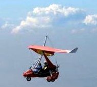
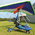
If I was flying a Trike without a GPS, eish lost for sure. How do you read a map on a trike? Strapped to your leg. Must be very difficult to see the detail on the map.
Anyway, VIVA THE GPS! 1 hour 45 min flying time to do 82 miles battling a head wind. Averaged 46mph. Not too bad but not very pleasant.
WHO STILL NAVIGATES WITHOUT A GPS
-
Rotorsrule

- First solo
- Posts: 80
- Joined: Wed Aug 13, 2008 3:34 pm


Re: WHO STILL NAVIGATES WITHOUT A GPS
My Problem is i have a very very old Map.
I do now and then plot my whole route on a map but i use a GPS and i have a spare just incase one dies.
I do now and then plot my whole route on a map but i use a GPS and i have a spare just incase one dies.
Gavin van der Berg - ZS-WWF
“The genius controls the chaos”
One of the Proud Chain Gang Founding Members
“The genius controls the chaos”
One of the Proud Chain Gang Founding Members
-
bobthebuilder

- Pilot in Command

- Posts: 923
- Joined: Sun Oct 12, 2008 8:00 pm
- Location: Johannesburg
- Contact:
Re: WHO STILL NAVIGATES WITHOUT A GPS
I use a map for every X-country. I have it in a plastic sleeve on my knee board. Turning the page can be fun. I shredded a map on a training flight once. It auto-unfolded.
Flying with a map and compass is way more fun than following the arrow on the GPS. I do have a GPS and use it more as a data logger than anything else.
Flying with a map and compass is way more fun than following the arrow on the GPS. I do have a GPS and use it more as a data logger than anything else.
Byron Kirkland
-
Rotorsrule
- First solo
- Posts: 80
- Joined: Wed Aug 13, 2008 3:34 pm
Re: WHO STILL NAVIGATES WITHOUT A GPS
JA, I can only imagine turning the map page in a trike..... 
I scanned a map, 1:250 000 and 1:500 000. Then print (A4) out most of the popular routes and laminated 2 areas together. I covered basically the whole TMA.
For other areas, crop, print and laminate. Put the route in before printing if it covers more than one page. The map dies just to quickly folding and refolding for all the different areas. I always have a complete map packed away. In case I fly of the lamination.
A permanent marker to plot routes on the lamination also works for me. Clean with spirits(the type you have to drink with a brown bread).
What I do like about flying with a GPS is that one can relax and just enjoy the view around you......O!? 2 mile and 10 deg of course.....steer steer..... enjoy.
Really looking forward to some great flying this summer.
I scanned a map, 1:250 000 and 1:500 000. Then print (A4) out most of the popular routes and laminated 2 areas together. I covered basically the whole TMA.
For other areas, crop, print and laminate. Put the route in before printing if it covers more than one page. The map dies just to quickly folding and refolding for all the different areas. I always have a complete map packed away. In case I fly of the lamination.
A permanent marker to plot routes on the lamination also works for me. Clean with spirits(the type you have to drink with a brown bread).
What I do like about flying with a GPS is that one can relax and just enjoy the view around you......O!?
Really looking forward to some great flying this summer.
Re: WHO STILL NAVIGATES WITHOUT A GPS
I also use a map for every X-country.My GPS is just for ground speed,and for back-up.
-
nicow
- The Big Four K

- Posts: 5056
- Joined: Tue May 24, 2005 7:09 am
- Location: Mooketsi,Duiwelskloof
- Contact:
Re: WHO STILL NAVIGATES WITHOUT A GPS
Me tooNicklaas wrote:I also use a map for every X-country.My GPS is just for ground speed,and for back-up.
-
John Young
- The Boss

- Posts: 1973
- Joined: Tue May 24, 2005 8:38 am
- Location: Jacksonville, Florida, USA
WHO STILL NAVIGATES WITHOUT A GPS
As a student, I was not allowed a compass nor GPS. Just the sun and a chart.
With 20,000 NM at sea mostly solo, I guess I know where North is.
With 20,000 NM at sea mostly solo, I guess I know where North is.
Was a sEXY trike. Now registered as N457YJ
-
bobthebuilder
- Pilot in Command
- Posts: 923
- Joined: Sun Oct 12, 2008 8:00 pm
- Location: Johannesburg
- Contact:
-
Leprachaun

- Frequent Flyer

- Posts: 1161
- Joined: Mon Aug 22, 2005 12:57 pm
- Location: Pretoria
Re: WHO STILL NAVIGATES WITHOUT A GPS
I navigate with a map , preferably 1.250,000-  the strikes are low and slow
  and you enjoy the ride - Mark 10 minute points and away you go
  .
.
By the way does anyone have the cd/ dvd with all the topo maps , I had one got loaned and never returned - we just got a new big / very big printer at work and guess who can print his own maps if only my cd/ dvd is returned , Leprachaun
By the way does anyone have the cd/ dvd with all the topo maps , I had one got loaned and never returned - we just got a new big / very big printer at work and guess who can print his own maps if only my cd/ dvd is returned , Leprachaun
A pilot lives by perfection , or not at all!
-
Madman

- The Boss
- Posts: 1569
- Joined: Mon Feb 22, 2010 12:17 pm
- Location: Crosswinds - An Airfield in the Wild West!
Re: WHO STILL NAVIGATES WITHOUT A GPS
MorningLeprachaun wrote:I navigate with a map , preferably 1.250,000-
By the way does anyone have the cd/ dvd with all the topo maps , I had one got loaned and never returned - we just got a new big / very big printer at work and guess who can print his own maps if only my cd/ dvd is returned , Leprachaun
I have that CD as well,will give it to Jacques or Neil to give to you this coming weekend as I won't be in JHB
Have an awesome one
ZU-BVV "The Black and Yellow Beast"
"There's a party in the sky"
"There's a party in the sky"
Re: WHO STILL NAVIGATES WITHOUT A GPS
And here you can get a video of how to read those BIG maps of Alex while traveling in an open cockpit at high speed. Its the second video from the top on the page:  http://www.infozone.tv/index.php?option ... &Itemid=68
Re: WHO STILL NAVIGATES WITHOUT A GPS
Yes that is beautiful ZS-NEL
I don't have anything infront of me except a pipe no Dash no Nofing
Now try that same excercise at 60MPH with nothing and see how mlong your map lasts.
I don't have anything infront of me except a pipe
Now try that same excercise at 60MPH with nothing and see how mlong your map lasts.
Gavin van der Berg - ZS-WWF
“The genius controls the chaos”
One of the Proud Chain Gang Founding Members
“The genius controls the chaos”
One of the Proud Chain Gang Founding Members
-
Porra
- Survived second engine out

- Posts: 350
- Joined: Sat May 28, 2005 9:30 pm
- Location: Gold Coast Australia
Re: WHO STILL NAVIGATES WITHOUT A GPS
Tailspin wrote:My Problem is i have a very very old Map.
I do now and then plot my whole route on a map but i use a GPS and i have a spare just incase one dies.
"Always remember.... You're unique..............just like everyone else...." 


-
Biggles

- Pilot in Command
- Posts: 770
- Joined: Wed Nov 02, 2005 12:29 pm
- Location: Cape Town/ Namibia
- Contact:
Re: WHO STILL NAVIGATES WITHOUT A GPS
After running around the patch for so long my GPS is just a way of comparing ground speed to airspeed and when skirting sensitive airspace. Having said that my compass is used even less... usually just for calling runway numbers. I have a map as a back-up in my knee pocket and a copy of any airspace changes in the other pocket.
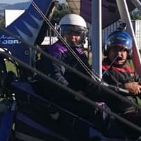
Trike pilot
Aerotrike Cobra
ZU-DLP
Winelands FAWN
Aerotrike Cobra
ZU-DLP
Winelands FAWN
Who is online
Users browsing this forum: No registered users and 9 guests