Postby gertcoetzee » Wed Mar 26, 2008 12:09 pm
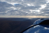
The other side of the coin are downdrafts. I often sit and look at the clouds cascading down Table Mountain, and sometimes "folding" on themselves.
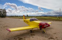
The following graph (and google GPS track) is of our flip back from Nieuwoudtville via Lamberts' Bay.
1. Niewoudtville lies on the ascarpment, at 2400ft ASL, and the ridge drops sharply down to 400ft. We took off from (1) and decided to climb to 3500ft, and as you can see had a tailwind of 20+mph.
2. Approaching the ridge, full RPM and you can see the drop in Altitude, and airspeed was still climbing, with bumps galore, so we turned into the wind, climbing before another attempt at crossing the ridge
3. take 2 at crossing the ridge, again with some fall, but bumps more manageble, with a bit of bumps, staying at
4/5 4000 to 5000ft until well downwind of that ridge, and stopping at Lamberts Bay (6)
(7) GPS not recording
(8) climbing over Piketberg
(9) Aurora
Blue Groundspeed (mph)
Red Altitude (ft)
Yellow Airspeed (mph)
You do not have the required permissions to view the files attached to this post.
Last edited by
gertcoetzee on Wed Mar 26, 2008 12:33 pm, edited 7 times in total.